
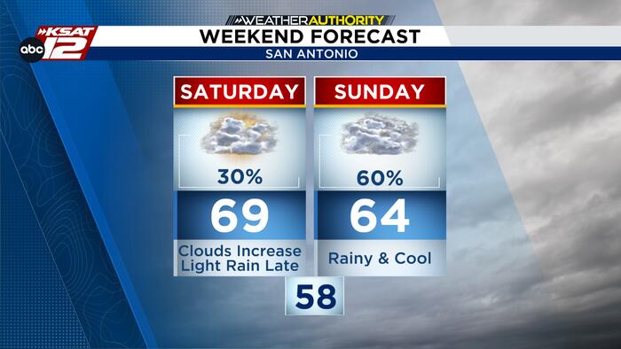
SATURDAY: MOSTLY QUIET WITH SOME RAIN
Saturday looks mostly dry with increasing clouds and highs in the upper 60s. A few spotty showers are possible later in the day, but outdoor plans should be fine. Keep an eye out for a stray shower in the afternoon or evening.

SUNDAY: CLOUDY AND PERIODICALLY RAINY
It looks like Sunday is shaping up to be a cool and wet one across South-Central Texas. We’re expecting scattered showers and periods of rain throughout the day, with highs in the low 60s around San Antonio and 50s in the Hill Country. While widespread flooding isn’t expected, some areas could see up to an inch of rain, and we can’t rule out a few strong storms, especially toward the Coastal Plains.

If you’re heading out, keep in mind that conditions will vary quite a bit, it’ll be warmer out toward Del Rio, so make sure you have an indoor backup plan for your Sunday activities!

CHILLY START, GRADUAL WARMING TREND
Cooler, drier air arrives in South-Central Texas Sunday night. Expect chilly highs near 60 on Monday and Tuesday, dry weather through Wednesday, and a return of humidity and rain chances by the end of the week.


